Limassol Forest Area Has River Valley, Citrus Groves & Vineyards
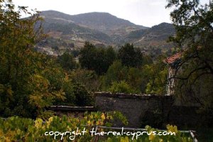
Limassol Forest Route is a spectacular thing to follow if you want to see river valleys, citrus groves and vineyards.
What Else Will I See?
This Is The Official CTO Route
Leave Limassol on the Limssol to Nicosia Highway at exit 24 and go onto the E128 to Yermasoyia.
Tucked between a cliff face and a riverbed, this villages narrow streets contain some find old houses, several tavernas and a country club.
Follow the signs for Yermasoyia Dam.
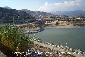
As you drive up you will see the market gardens and citrus groves in the riverbed to your right/
Note the distinctive rock-face atop a crag on the opposite bank because you will see this from a difference angle later.
Anglers and walkers can take the road across the dam wall, signposted for Finikaria for some good fishing locations and nature trails.
Click here for information about fishing permits etc
Continue on the E128 through Akrounta.
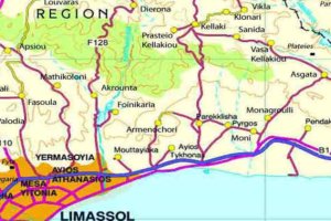
Akrounta Village
A rapidly expanding village on a tributary of the Yermasoyia River.
The road now climbs steeply with a deep valley to your left and a rock face to your right.
As you get higher, the valley is to your left and there is a wonderful view back to Limassol & the coast When you reach the saddle you enter the edges of the Kakomallis and Limassol Forest.
Several holiday homes have been built in this area as it picks up the cool breezes from the north and south.
Driving towards Dierona, the village if Kellaki is on the hillside opposite and Prastio is in the valley below.
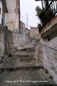
Dierona Village
This village lies on the west bank of the Yermasoyia river and its chief products are citrus fruits, and mandarins are the speciality.
Only a small village, but friendly. There is only one place to stop and have a coffee and buy something to eat.
If you are moving on, now follow the signs for Arakapas.
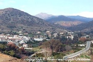
Arakapas Village
This village is lying in a natural amphitheatre and one that has given its name to part of some unique geology of Cyprus.
The ARAKAPAS SEQUENCE runs along the southern edge of the Troodos Ophiolite and some of the pillow lavas in this area are on brown-red iron-rich mudstone.
Go left at the signpost to the village centre and cross the narrow bridge.
The enormous eucalyptus trees to the right indicate plentiful water.
Go right here at both forks in the village and go right again into the square.
At the far end, on the corner of the road to Sykopetra is the very beautiful early 16th century church of Panayia Iamatiki.
The church is renowned for its Italo-Byzantine frescoes.
Also look for the two well preserved 16th century paintings of St Mamas and the saints Mary of Egypt and Zosimos.
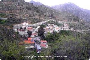
Sykopetra
The to the village goes through a wooded valley before climbing very steeply.
The village, which clings almost precariously to the hillside, originally belonged to the Knights Templar.
On the hillsides below the houses are huge prickly pear cacti with large racquet shaped leaves that have very sharp spines.
In Summer, the delicious fruit from them are peeled and chilled and eaten and much enjoyed by the local villagers.
Leave the village on the road signposted for Prophitis Elias, and then take the left fork at the top of the hill, onto the road to Ayios Konstantinous.
Ayios Konstantinous
You can take a side trip to the hamlet of Profhitis Elias, which sits like an eyrie on a hilltop, offering expansive views of the surrounding hills and deep valley below.
The main route goes onto a good gravel road after about 1km as it drops down steeply to the valley bottom and climbs the other side.
On the way, you go through terraces of citrus trees, a small forest, an area of Mediterranean Maquis, vegetable plots and finally as you join the asphalt road again, grapevines.
Ayios Konstantinos, which has some well-preserved traditional buildingsm is one of the Commandaria Wine Villages and is a typical Pitsillia region village surrounded by vineyards.
The tiny church of Ayios Konstantinos and Ayia Eleni in the village centre is characteristic of the region.
Drive through the village and go right at the signpost to Ayios Pavlos
Ayios Pavlos
This little village on the southern most slopes of the Papoutsa peak has abundant water, some of which gushes out of the rocks at a place called Styrakas, which is surrounded by large walnut and plane trees.
Drive through the village, following signs for Kalo Chorio and then go left at the signpost for Limassol.
| You are now in the heart of Commandaria Wine Country |
Go left at the t-junction and follow the sign for Louvaras.
Louvaras Village
Drive through the village until you come to the very old part where the streets are made of concrete and very narrow.
Park the car and walk along Ayios Mama Street following the signs for Ayios Mamantos 15th Century Church.
The church is below road level and all you can see is part of the sloping red roof.
The church houses some of the islands best preserved 15th century frescoes.
In the churchyard is a restored olive press.
A walk around this part of the village will give you a glimpse of old stone-built houses, some of which are restored, large bread ovens and massive pitharia wine jars.
To leave, go back through the village and go left at the small green signpost to Kakomallis Forest Station.
After 200 metres go right at the crossroads onto Kato Evagorou Street.
As you descend you will be driving through the western edge of Kakomallis Forest.
Go left at the main road and go left again at the signpost for Apsiou.
Apsiou Village
The map at the village entrance points you to the paved village centre, a winery, some traditional village houses and an old water mill.
Leave on the road signposted to Mathikoloni and go right following the blue road sign at the fork after the village.
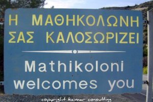
Mathikoloni Village
As you drive down the mountain there is a deep river valley to your left.
Mathikoloni, the modern part of which lines the main road, once belonged to the Grand Commanderie of the Knights Of St John.
The old part of the village is on the slopes below and legend has it, it was made up of 7 quarters and 7 churches!.
There are the remains of the two watermills by the stream that bisects the village.
As you continue, the view opens up and you can see the village of Akrounta, in the valley below and the road along which you drove earlier snakes up the hillside opposite.
Just before the road turns away from this valley, there is a glimps of the Yermasoyia dam below and opposite, at eye level is the rock-face on top of a crag that you passed on the way to Yermasoyia dam.
After driving through a small gulley an amazing panorama awaits you.
The vista sweeps from Amathus to your left through to the Akrotiri Peninsula
Many people from Limassol have built houses in this area, as the good rood allows them to commute daily to work enjoying that wonderful view on the way.
When you get to the roundabout at the bottom, go left and onto the motorway to head home to your destination.
You can get this route if you prefer from your local Cyprus Tourist Board
Related Pages
Limassol Travel West For History & Antiquity Cyprus Wine Villages Limassol To Troodos Solea Valley Limassol Travel Leave The Limassol Forest & Return Home


New! Comments
Have your say about what you just read! Leave me a comment in the box below.